
Pictures and Reports from Members Walks
This page is for members of the club to report any walks that they have done that would be of interest to other members. These are not necessarily typical of the usual club walks.
The most recent walk is immediately below this — scroll down the page to see older walks. Also, you can click on the small "thumbnail" images to see larger images.
If you have your own walk that you think might be suitable for this page, then please send it to WalkReports@nevishillwalking.club and it will be considered for inclusion.

Sunday 14th to Monday 15th July — Trl — A wee solo summer walk in Knoydart
After completing some 190 odd Munros, I have at long last come to some ‘order’ in the approach to the remaining Munros to be bagged and the two Knoydart hills, Luinne Bheinn and Meall Bhuidhe were on the list. The plan was to go over on the Knoydart ferry from Mallaing and stay overnight on the hills hence some good weather would be needed as I had no plans for taking the tent, only sleeping bag, mat and my two person very lightweight shelter of 380gr compared to the tent of 1.7 kg.
Keeping a close watch on the weather forecast, Sunday 14th into Monday 15th July looked promising so a ferry ticket was booked and plans made. Setting off on Sunday morning, leaving plenty of time to get to Mallaig and finding a parking space which can be difficult in July and August, particularly on a sunny and warm Sunday. The trip went well until Glenfinnan which was overflowing with people and cars, I slowed down and kept eyes and ears open. To my horror of horrors a large jeep like vehicle, non GB number plates came towards me on the wrong side of the road, I peeped my horn but no reaction from the other car, realising that the other car was well and truly heading towards me and on a course of head to head, in desperation as I had nowhere to go, I leant on the horn and almost stopped, thankfully the other car eventually approx 10m away from me suddenly must have caught on and miraculously managed to miss me as he swerved on to the other side of the road where he should have been. I felt quite shocked about what might have happened. Thankfully the rest of the journey was rather eventless and I got to Mallaig in good time for the ferry, found car park and headed for a cafe for an excellent crab sandwich followed by a soft ice cream, which took me almost to the top of the first summit, energy wise.
It transpired that Western Isles ferries had acquired a brand new, fast going boat so the journey over to Inverie took less than 30 minutes. A bit sad though as the old boat makes such a lovely sail over. I watched a couple of Gannets fishing at the entrance of Loch Nevis, impressive diving and beautiful birds. Otherwise sealife seemed rather relaxed on this hot and sunny Sunday apart from the harbour seal that came to say hello just before we left Mallaig.
Landed at Inverie about 2.45pm and headed straight for the hills, my route was to follow the Walkhighlands route, Meall Bhuidhe and then Luinne Bheinn with a stop overnight at the last summit. However, deep in my thoughts and feeling rather hot in the afternoon sun trying to adjust to the load of the rucksack, I completely bypassed the turn off for Meall Bhuidhe and it was not until I was by the lochan that I realised my error. However, going back was not an option so the route had to be reversed and done clockwise, in hindsight I think that was a good move and I sometimes wonder about unconscious decisions. The track up the glen towards the Mam Barrisdale is a lot gentler in ascent and despite the wet and boggy bits of the path, it was quite enjoyable to walk up to the col. The glen is so beautiful with the lochan, surrounded by the hills and some trees too. I enjoyed seeing a lot of wild flowers and countless dragonflies darting about – and I met a lady speaking to them or at least that was what she told me. Just before the coll I decided to have a rest, a cup of tea and the bun I had bought at M&S, whilst I studied the track up to Luinne Bheinn. Why I then did not follow the track along the ridge up to the summit but rather continued on a lower track which was quite boggy in places, I don’t know, it seemed easier although I kept saying to myself this is not the right track looking up on to the ridge.
Anyway I did get to the summit just before 7pm and met a man who had put up his tent and intended to stay the night, he had been there since 1.30pm in the afternoon, goodness knows what he was doing all that time. I explained that I was heading for Meall Bhuidhe where I intended to stay the night or at least until sunrise. The track was a bit craggy and steep in places but nothing difficult, the only annoying parts being the wet and boggy patches. The early evening sun shone wonderfully on Druim Leac a’Shith, so I decided to stop and have something to eat, I was getting a bit hungry by this time. It would have been a good place to stop for the sunset but I had decided to head for the summit of Meall Bhuidhe for the night so scrambled up the ridge and frightened the deer away from their obvious hill. It was well after 9pm by now and the breeze which had been so wonderful all day had dropped completely, it was lovely and calm and felt warm but it was also perfect for midges – at 946m !!! is there nowhere safe from these little b.....s. I put out my sleeping mat and sleeping bag and eventually had to wrap the shelter around myself to keep the midges out. However, the views and the sunset were spectacular and as my shelter has two little windows I could still enjoy these from the inside safe from the midges. As the sun set and disappeared behind Skye somewhere I fell asleep for the whole of 1 hour and 30 minutes and woke up at 11.58pm that was me awake. But I was just taken aback by the beauty of the sky around, to the north it was bright red with a dark, dark blue on top and the hills silhouetted beneath. To the south there was an almost full moon shining and eventually it turned dark red before disappearing. As the morning was approaching the sky to the north changed to a dark yellow and at the promised 4.48am the sun appeared from somewhere behind the hills of Glen Affric. Soon the sunshine moved down the hillsides into the glens and a new day started. Heading off the west ridge of Meall Bhuidhe I enjoyed the views of the small isles and also Skye where I had walked a few weeks back but unfortunately with not such good weather. In a 360 degree circle I had noted from the summit of Meall Bhuidhe all the hills around and trying to remember their names and times when I had visited, what the weather was like and how the viewpoints change and plans are made.
The last bit coming off the hill was not ‘funny’, I ended up in bracken to my middle, I don’t think you could avoid it and got thoroughly soaked before I landed on the path back to Inverie, thinking how glad I was for not having come up this way. Fortunately, it was starting to warm up by this time but my feet were wet. Anyway, my feet squelched their way back for the 8am ferry to Mallaig and a visit to the bakery for coffee and a sticky bun before I headed off back home. So those were Munro no 196 and 197.
I could also add that on the way out of Mallaig I picked up a hitchhiker, a young German guy who had done a month of voluntary work on Rum and he was also a Bothy Bagger which provided an interesting subject and kept me awake on the drive all the way to Ballachulish.
Trl
Saturday 18th to Monday 20th May — Gavin, Jan, Trl — Skye Cuillin
Three ‘interesting’ days in the Cuillins
Summary
Saturday - From Sligachan, Sgurr nan Gillean via south-east ridge, Am Basteir (via Lota Corrie and Bealach a’ Bhasteir), Bruach na Frithe, descent via Fionn Choire - total ascent 1700m, distance 20km, start/finish times 1100-2030
Sunday - From Glen Brittle YH, Sgurr a’ Mhadaidh via An Dorus approach, Sgurr a’ Ghreadaidh via An Dorus, descent via Eag Dubh - total ascent 1100m, distance 11km, start/finish times 1000-1630
Monday - From Loch Slapin, Blabheinn via south-east ridge from Fionna-choire, descent via Coire Uaiganeich - total ascent 1000m, distance 10km, start/finish times 0800-1345
Saturday
We stopped at the Cafe and Bakehouse by Eilean Donan castle, Trl had mentioned the place might be serving fresh cinnamon buns and as I walked in I was greeted by the smell of cinnamon and the sight of two large boxes of buns behind the counter, there was no question about buying one, they were incredibly good, warm, gooey and sweet. This was a great start.
Back in the car a message revealed the others unfortunately weren’t going to join us, but rechecking the forecast didn’t put us off, so we continued on to Skye with our fingers crossed.
Our hopes rose as we approached the mountains, we parked up and set off about 11am from Sligachan, it was dry with glimpses of the tops and the stark jutting out Bhasteir Tooth on the skyline.
Gaining the main ridge south-east of Sgurr nan Gillean we were treated to some awesome views, from the sound of waterfalls from the Lota Corrie below our feet, to the main ridge across the skyline black and ominous. Here Gavin traced out his planned, bold route, for the day: after Sgurr nan Gillean we could retrace our steps - avoiding the descent of the hair-raising west ridge - and head south, drop right down into Lota Corrie then all the way back up to Bealach a’ Bhasteir, climb Bhasteir and back, skirt below Bhasteir and upto Bruach na Frithe before descending back to the car. I was a newcomer to this bold plan having only signed up for Sgurr nan Gillean, but the others had kindly offered to let me tag along with them, though I was aware I was probably letting myself in for something interesting.
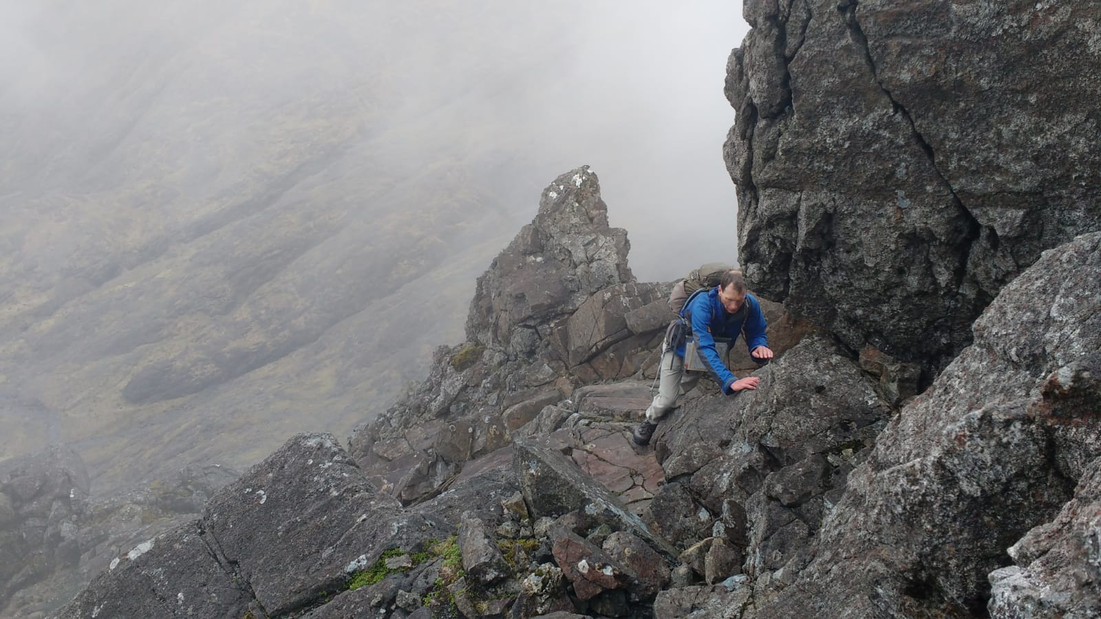
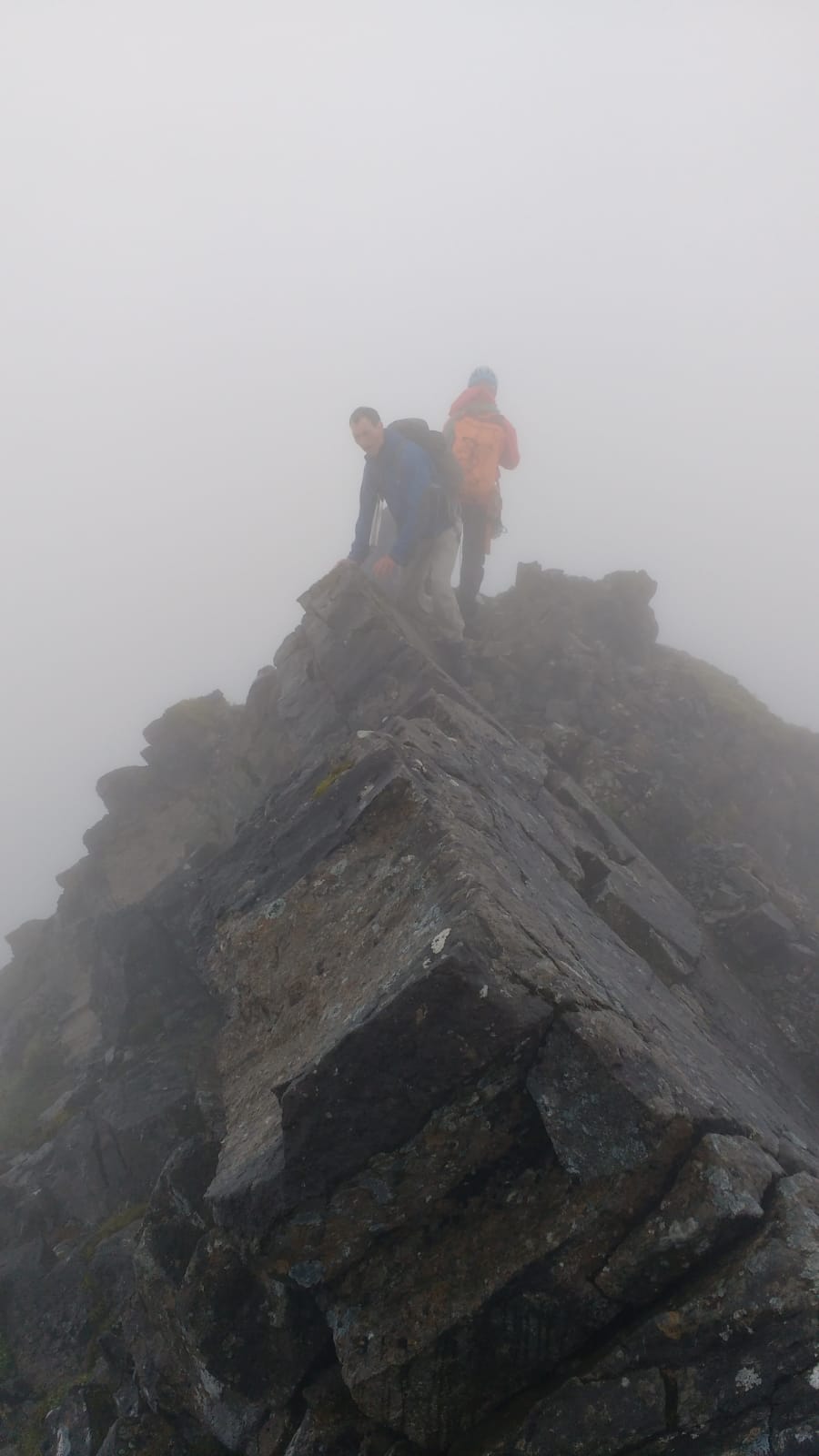
On our right Sgurr nan Gillean was in the clouds, we set off up the exposed ridge reaching the crux of our route about two-thirds up, on the left-side of the ridge a couple of moves went up to a protruding rock and an interesting step below and around onto an exposed slab, Trl lead the way and we all passed it eventually. Finally at the top the summit cairn had to be reached by an airy traverse - of course the cairn was on the further point from us - the clouds had cleared by now and we gingerly clambered across to the cairn, then we could finally stop and enjoy the stunning 360 degree panorama.
Coming down was slower, though we were retracing our steps we reached the crux and looked at various alternatives before committing to it, again Trl lead but it wasn’t too bad with some good bum-shuffling moves.
At the bottom we set off straight-away following Gavin on our planned route, by-passing below Sgurr Beag we stopped for a snack, then he picked a descent point off the ridge into the little visited Lota Corrie, descending 150m via an initially shallow gully we arrived by a huge boulder resting on a large grassy terrace, stopping to listen momentarily we could hear the distant tumbling river and nothing else, it was a great feeling of solitude in the grand arena of mountains. We continued traversing staying as high-up as possible Gavin really seemed to be following his nose as we ascended a narrow grassy ledge, angling back up we were soon onto steep scree and eventually to the base of a rock wall below the bealach, following a line up the middle it made an interesting obstacle, but it wasn’t too high to feel really exposed and made a nice end to the whole adventure. It was tiring but a great experience in getting away from the trodden path, especially compared to the ever popular main ridge.
At this point a call of nature meant I had to leave Trl and Gavin to summit Bhasteir, but about an hour later I rejoined them descending and we continued to Bruach na Frithe.
[ Gavin: Trl and I left Jan at the Bealach a’ Bhasteir. We headed up the ridge to the point where we were looking down above the Bad Step. There was no way that we would manage this on our own. So from here we turned back a short way and found a way by ledges on the left down to the gully below the col beyond the Bad Step. From here it was straightforward to get back onto the ridge and up to the summit. We passed three climbers who had no trouble doing the Bad Step. These were the only people we met all day although we saw many others in the distance. On returning to col before the Bad Step we turned right down the gully a short distance before following ledges that led back to the ridge much further on. We descended to the bealach and headed down under Am Basteir to were Jan was waiting for us.
This route is not mentioned in many guide books, but makes it possible to get up Am Basteir without a Very Difficult climb, just a grade 2 scramble. It is described in the SMC Skye Scrambles book by Noel Williams: route 65a. ]
Fatigue was setting in by now and also the clouds, we summited the last Munro and then started gratefully down into Fionn Choire, the way was steep and very loose, Gavin advised lots of care to be taken and to move close together to avoid knocking a rock on each other, this was good advice (and preparation for tomorrow!), as the slope eased and we moved faster Trl took a tumble and cut a finger, so we paused for first aid and took a moment for her to catch her breath. Carrying on we were soon on easy grassy slopes and a long long descent back to the hotel arriving at 8.30pm.
We opted to eat at the hotel, though the place was packed as it was Saturday night, so it was a slightly tortuous wait standing for a table, but when we were sat the servings were generous and we were soon patting our bellies and listening to a band play. Still we had the business of finding a place to sleep, in the half-dark and cloud we set up camp on an obscure bit of moorland on the way to Loch Eynort and soon we were tucked up in our sleeping bags.
Sunday
The next morning dawned with low clouds and rain, not inspiring to get up to but thankfully it dried up, after breakfast we broke camp about 9am and headed to Glen Brittle YH to check out a couple more Munros.
Starting at 10am the cloud hung around 600m as we climbed up to the scree line, using GPS we checked to ensure the endless scree slope we were climbing was heading to An Dorus and not Eag Dubh, another endless scree slightly to the right. Bypassing the mouth of An Dorus we traversed left up a rock buttress to the summit of Sgurr a’ Mhadaidh (pronounced Vatai), near the top we caught up with a guide and two clients but barring our way to the official summit was a perfect arete shaped slab, on one side a smooth slope plummeted into the cloud and likely abyss, Gavin chose to traverse below it on the other side, I decided the least scary way was crossing direct ‘a cheval’, not having much experience with this technique it involved some discomfort before getting the hang of it, Trl later described it as the most terrifying part of her day! The three of us along with guide and his clients gathered at the true top, we explained our plan to the guide retrace our way back to An Dorus and on to Sgurr a’ Ghreadaidh, he asked if we knew about the climb up out of An Dorus, Gavin said he had done the climb up before and we were going to then descend via Eag Dubh to avoid down-climbing. The guide acknowledged this plan, but sounded unconvinced!
A short while later he met us at An Dorus pondering the way up, thanks to his advice and some encouragement we were all soon passed the obstacle and being assured by Gavin that - as far as he could remember all the hard bits were behind us! Then we came upon another obstacle, “hmm this looks interesting”, although a short step-up the rock was wet and the Gabbro’s confidence-inducing grip reduced, the whole ridge at this point was a long steep slope disappearing into the clouds below us, so the stance was awkwardly sloped and the step-up slightly overhanging. Again the guide appeared and commented to his clients that it also looked like rocks had recently dislodged and fallen, where I was stood, but he passed me and casually passed the step and belayed his clients without any comment, and we decided this was getting a bit embarrassing! Gavin found his own alternative route traversing on the slope below, the sight of which made me decide I would stay and give the summit a miss! In the end Trl followed the move the guide had taken and made it look fairly easy. So they both continued to the summit. Standing alone in the cloud, above the yawning black chasm of Eag Dubh I passed the time eating and trying not to look down.
[ Gavin: From here to the summit was quite straightforward. We met the guide again at the summit, and he was still rather concerned as to whether or not we knew what we were doing. We then returned back to Jan for the scramble down Eag Dubh: supposedly a grade 2 scramble. The step that was so awkward on the way up was actually easy to descend once we knew where we were going. ]
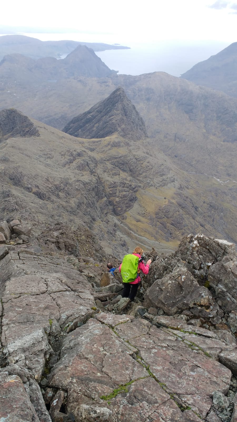
After about half-an-hour the others returned and easily down-climbed the step and we set off to descend into the gloom of Eag Dubh. The two walls rising up above us took away the sense of exposure but it was steep and the rock was basalt which is very slippery when wet, at one point we chimnied a narrow slot to bypass a drop, you couldn’t see your feet and there were few footholds, I somewhat keenly led the way feeling it would suit my caving skills - not that I would wear an expensive Goretex jacket when caving! Sliding myself down using bodily friction I found a stance and helped ferry the others’ rucksacks as they came down after. For what felt like a long time we then very gingerly carried on down the rock chute, I was suspicious of every rock, rocks which I would normally expect to be too heavy to shift were unstable and Gavin pointed out a stack of large rocks on one side of the gap to be carefully bypassed. We eventually reached an obstacle that made us climb back-up a bit and to the left out of the gully and soon we were moving more freely, further down descending a lovely section of steep gravel, almost like deep snow, which was great fun.
Back in the corrie bottom we enjoyed the walk out, it was brighter, the sun was trying its best to break through the cloud and occasionally we stopped to look back at the towering black mountains, summits still in cloud. We met a lone hiker coming up and she stopped to ask us what the route up was like, she said she was from the Rockies, I asked her if she had been on scree before as there was endless scree before getting to the ridge. She said she had. We left her to carry on, but I had that feeling that sometimes words aren’t adequate enough to describe what we had come down!
In the lower corrie Trl stopped to refresh her weary feet in a cold mountain stream. We were back at the car for 4.30pm with one thing on our mind, coffee. From Glen Brittle our plan was to head over to Blabheinn and camp, before ascending it the next day. En route we stopped at a cafe in Broadford and nearly got distracted by their fresh pizzas, but managed to resist and just stick to coffee - confusingly, and then amusingly, after Gavin had ordered his latte - the (seemingly) trainee waiter came back to check if he wanted milk with it…
Back on the road we drove past Torrin and parked up near a place Gavin recommended, walking a short way up a glen to a spot by an almost dry river bed, the location was spectacular and we had all evening to relax, cook and enjoy it.
Monday
Monday the tops were in cloud but otherwise it was dry and clear. We broke camp at 7.30am and started up about 8am walking from Loch Slapin on the east side of Blabheinn.
With just a couple of short stops en route we were at the summit by about 1230, coming via the east ridge with the odd glimpse of Clach Glas through the clouds. The scramble to the summit was a bit interesting, it was a shame there were no views for Trl, she was celebrating finishing her last Munro on Skye! And the sixth of our trip. But after her previous attempt had been defeated by extreme winter conditions, at least it was dry this time.
From the south summit we descended south-east following a path initially down scree before reaching a col, there we dawdled while taking in the moment - the place and the views were beautiful. As we continued down we met several walkers lumbering up, luckily for them the summits were clearing and the sun starting to appear, when we said we had been in the cloud at the top - one of them drily said it was our own fault for being so keen! We briefly visited the substantial lochan in Fionna-Choire (450m), a great-looking camp spot, then chose to follow Gavin, as he opted to follow the stream bed into an interesting ravine down the mountain, it was a nice little adventure and we encountered many wild flowers flowers along the way. After a stop to bathe feet in the cool water we were soon back to the car, tired but happy.
Sadly the Blue Shed Cafe in Torrin was closed, I had had my eye on it all day, literally! (It is currently for sale according to their Facebook page), so we stopped again, in a different cafe, in Broadford for a celebratory coffee and cake, and to reflect on a fabulous few days before heading back home - over the sea from Skye.
Jan
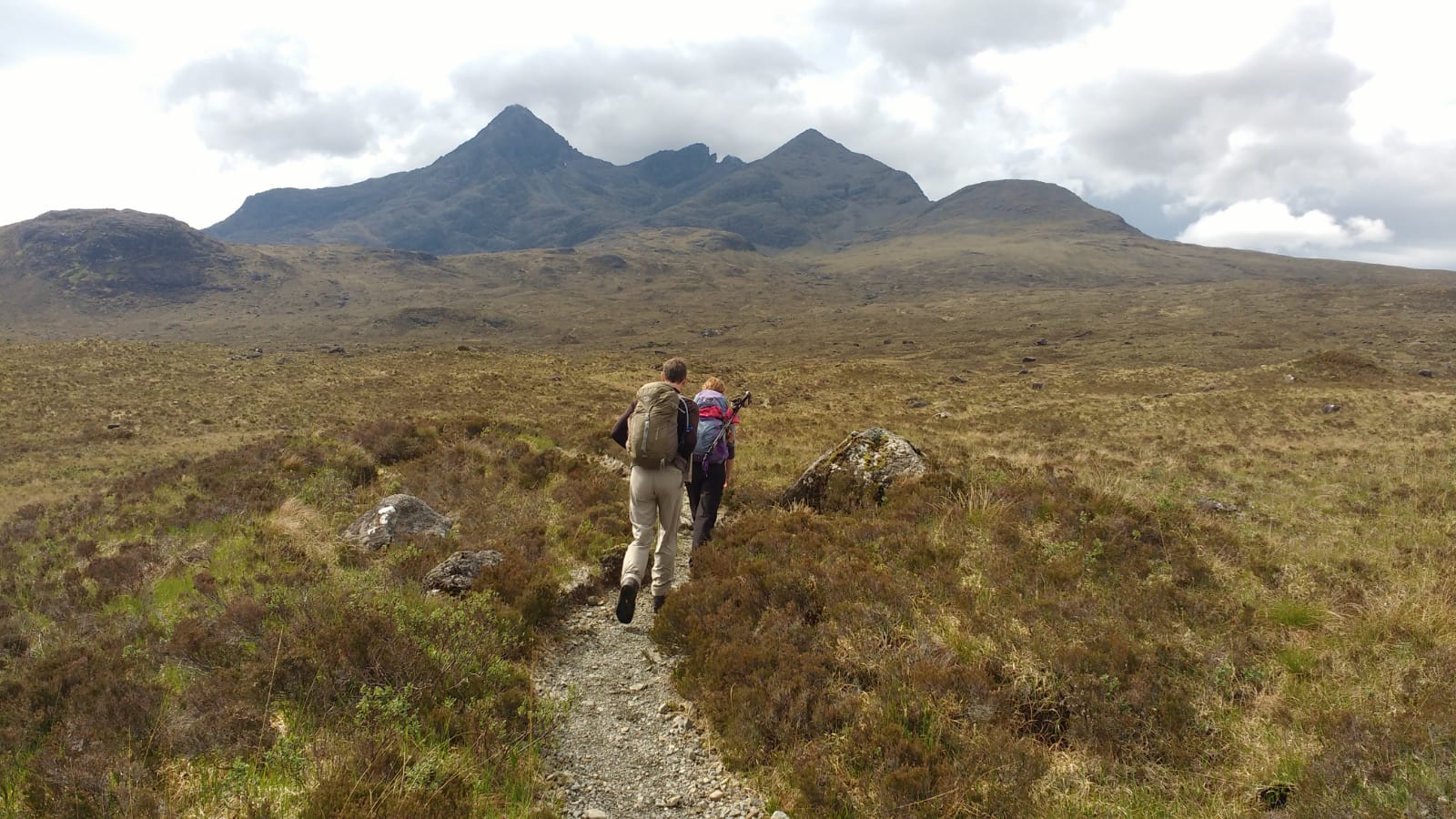
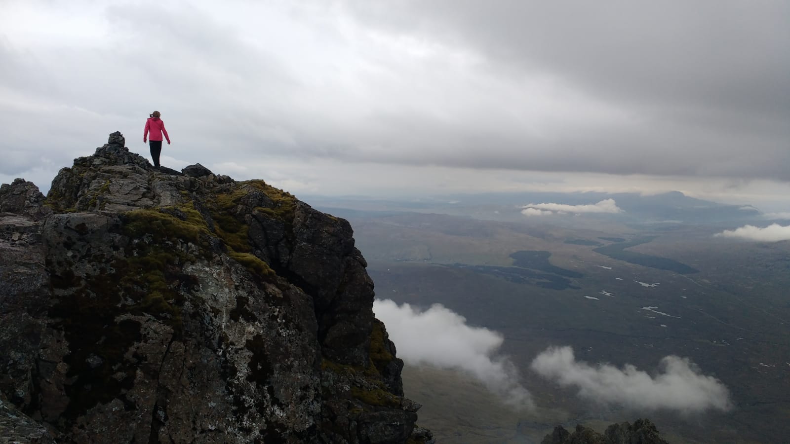
Photos from Jan:

July 2018 — Trl — Corrour
An Alternative Walk – report
On Thursday night sitting at the computer looking at the planned walk for the Ramblers on Saturday, meeting at Bridge of Orchy station for train to Rannoch and walk over Carn Dearg to Corrour. I do like the idea of going on the train to Rannoch or Corrour, it makes it a different day out and Loch Ossian is such a lovely place. But I was not sure whether I would rather climb something I had not done so far. With the warm and sunny conditions continuing, I decided to do a longer walk and an idea formed.
So looking over the maps again, consulting Cicerone ‘Walking the Munros’, Met Office — good conditions for Friday and Saturday with some rain coming in on Saturday night — and Gavin — was that a good idea?!! I had it all planned, I would attempt the 6 Munros at the back of Loch Ossian. Friday morning was spent packing; maps, compass, GPS, food, 2 flasks of tea, water, snacks, some extra warm clothing — which was need, including light gloves — sleeping bag and underlay. I was to spend the night out in the open under the stars to enable an early start in order to complete the 6 Munros and would not take a tent as I had to carry everything.
The train from Fort William at 17.37 to Corrour for 18.25. I was the only one getting off at Corrour station but plenty of people were boarding the train. It was very hot and sunny in the late afternoon for the 7km walk along Loch Ossian and passed the Shooting Lodge, a usually enjoyable walk but the clegs made it impossible to stop for any length of time. At approx 500m past the Shooting Lodge I turned E over 2 bridges up the Hydro track for another 2km. The river was flowing well and I filled up my second bottle just in case and headed up towards the rocks of Creagan na Craoibhe. Quite a breeze had built up although the evening was still wonderful with a clear sky and plenty of sunshine. I decided to stay the night by the rocks as they provided some shelter, not having a tent this was important. At once I stopped around 9pm and sat down I felt the effect of the breeze and it was getting cooler, so extra clothing was essential. However, I was rewarded by stunning sunset whilst I ate my ‘Tesco best Moroccan cuscus salad’ with ‘tuna infused with chilli and garlic’ — best to ward against witches and other underlings when staying the night in the open, who knows!!
I was quite tired and folded out the sleeping map and crawled into the sleeping bag with all spare clothing, two sets of Merino, fleece, Paramo jacket, and down bodyliner, plus gloves, could have done with some warmer trousers. It was not warm and I pulled the string so the sleeping bag hood was covering most of my face but I could still feel the cool, fresh air on my face. As I settled I suddenly remembered that I needed to start walking early to see the sunrise at 4.06 on Beinn Eibhinn and got out my phone to set the alarm for 3.15am!! With that done I drifted back into a doze but also noticed the stillness of the surroundings; the wind died down with the sun gone, faint stars began to emerge on the sky but it never got dark. I imagine it never does get dark on the hills midsummer when the sky is clear, I noticed a bright orange glow to the NE. It was wonderfully quiet and peaceful, the only disturbance was a big bird swooping close over me, I presume it was a Raven looking for something to eat. It made me think of Nan Shepherd describing how she loved to fall asleep in the heather, I don’t think she stayed out at night though.
My sleeping bag is another story, it is red and has a 100% down filling but it is not the warmest. What more, it dates back to 1972!! is in perfectly good condition and has had a few adventures, travelling across Europe on trains, hitch hiking up and down Norway, and lots of nights out in the open — a long time ago — but one memorable night on the hill above Hammerfest — the most northerly town in the world apparently — and being woken up by a herd of Reindeer grazing next to me. So this adds to the story of my sleeping bag.
Needless to say I did not sleep much and I decided to get up and was walking by 3.30am. The ground was still dark but the pink high in the sky gave a promise of the dawning day. I was still wearing all my clothing but layers were peeled off over the first tops and it became another hot, sunny day with a light breeze.
Walking up to the first Munro top felt easy as I had started half way up the hill and the first summit of Beinn Eibhinn was reached by 4.15, just in time to see the sun shining through the gap between Aonach Beag and Geal Carn. The ridge gave some good views of the route ahead and I sallied forth enjoying thinking that I am probably the only person on this hill just now. There is a fairly steep descent and ascent of approx 250m to reach Aonach Beag. A path leads off the bealach Leabaish Cruisgach into Allt Coire A Labhair, useful for alternative routes. My original plan had been to do just Beinn Eibhinn and Aonach Beag but Gavin advised that if I did those two the next one was not far off. This was probably where my plan went a bit OTT. Anyway I carried on to the summit of Geal Charn which did not take long so thanks for that Gavin and I rewarded myself with another cup of lukewarm tea from my flask but it tasted wonderful. Looking back I noticed lovely views of Ben Nevis, the Grey Corries and the Mamores in the early morning sun in the distance. It never fails to surprise and astonish how beautiful these hills are any time of the year.
Carrying on from Geal Charn I headed over a large area of dewy, wet grass, it made my boots wet on the outside. I almost had forgotten about that with all the dry weather we have experienced lately my boots had taken on a rather grey colour from the dust. The walk from Geal Charn to the next summit of Carn Dearg is a bit more challenging with a rather steep descent, there is a path, one walk report states it is 50m N of the big waterfall, I think it is a bit further than that. However, aim for the waterfall and look N for the path down the Aisre Ghobhainn, it becomes a bit rocky and takes you up the small top of Diollard a Chairn and further along to Carn Deag. It was now 6.30am and time for breakfast, banana and half a sandwich, no porridge I am afraid. I was now trying to make a decision about what to do next, I needed to be back at Corrour station for the 15.24 train. So making some calculations about how long it would take me to get off the hill to Culra Lodge and then over to Beinn Bheoil and Ben Alder, I decided that I needed to be on Ben Alder by 11am to give me enough time to walk out. Whilst thinking I did look over to Ben Alder which looks spectacular from this place and I thought it would be nice to do the scramble up but that meant I would miss out the other Munro. These are very difficult decisions to make for a Munro bagger! Anyway I headed straight down steep hillside towards where the river Allt a Bhealaich Bheithe meets the Allt a Bhealaich Dhuib, a descent of approx 500m and did my legs feel it!! But no time for a paddle in the river this time, although it was very tempting as the temperature in the glen was by now warming up nicely. No problems crossing the river though with so little rain over the last fortnight either. Having said that, I had no difficulties finding good water on this walk which helped the load.
I followed a path up onto the ridge toward Beinn Bheoil and then onto the next hill Sron Coire na h-Iolaire which all sensible walk reports say you should not try to avoid, and I did as told. Looking at the last ascent up towards Ben Alder I was beginning to feel the strain and tiredness of this long walk, my shoulders were aching from carrying the heavy rucksack. I had some thoughts of doubt whether I could finish the walk but quickly put them to the side and decided that I needed a good rest of at least 10 minutes, ideally I thought 2 hours of Nan Shepherd sleep would have been great!! But I would then miss my train and my husband would miss his dinner. Anyway the last of the cold tea and a big scone purchased the day before did the trick and got me up the rather steep final ascent to the ridge and on to Ben Alder for exactly 11am where I met the first two people I had seen since the day before.
Beginning to become a bit anxious about timings, I did not linger and headed W towards the Coire na- h Eiginn and Coire Labhair, probably the less steep descents down to the river and a very long walk of 14km out to Corrour Station. The path along the river is ok if you stick to it and eventually it becomes the Hydro track for a couple of km and then along Loch Ossian — and the dreaded clegs. I did not have time for stopping much apart from drinks of water. But got to Corrour station at 14.50, enough time for a soda water and lime, the best I ever had and a packet of crisps, boots off of and a lie down on a very handy bench in the garden.
That was approx 50km, almost 2000m of ascent in 14 hours in total of which I did 38km in 9.30 hours on Friday.
Got the 15.24 train back to Fort William and was home in time to make my husband’s dinner and tell the tale.
Trl
June 2018 — Gavin — An Teallach to Slioch (and others)
Earlier in the year I had a few backpacking trips over the hills: two nights in early April from Applecross to Strathcarron, three nights late April on South Uist, and seven nights early May in the Achnasheen area when I finished with a big day over all the Fannich hills in the strongest gales I’ve ever experienced. I was now fit enough to do my biggest walk for many years.
If you want to follow my route, then you will find almost all of it on map OS19. The goal of the trip was all the Munros, Corbetts, Grahams, Munro Tops and Simms in the area. The Simms are hills over 600m with 30m drop and include all the Corbett and Graham Tops and most of the Munro Tops. In case that wasn’t enough, I also ticked off some more minor tops on the way! I’ve avoided mentioning every little hill I did as this would make the description even longer. Just assume I did everything there was to do!
A good thing with the fabulous hot weather we had this spring was that I could take minimal clothing for poor weather. I took a lightweight Paramo jacket, also useful as a windproof layer and lightweight trousers with lightweight waterproof over-trousers. I also had less warm weather clothing than normal knowing that if necessary I could wear multiple base layers for warmth. This was never necessary. As usual I wasn’t carrying a tent, just a tarp with a separate groundsheet. Also, as usual, I went self-sufficient which means that I carry all food for the trip.
On the 2nd June I went by bus first to Inverness and then by the Ullapool bus to Braemore junction (OS20) arriving about 6pm. From here I managed to hitch quite quickly a few miles W to the highpoint of the road before heading up Meall an t-Sithe and hence W to the Corbett summit of Creag Rainich (OS19) where I camped. I had meant to pick up water at the lochan at NH105746. Unfortunately with all the hot weather we were having, the lochan had greatly reduced in size and there was no outflow. The only water I found was a trickle that would take half an hour to fill my water bottles. (I usually need about 3 litres overnight to have sufficient for the next morning). I gave up and made do with what I had brought from home. This was a lovely camp spot with lots of Moss Campion flowers around the tent. The views were superb and it was warm enough to walk around the summit in bare feet.
The first full day of any trip is always the hardest, and this trip was no exception. The first day that you start is short and you are fresh and can push yourself, but tend to finish late. You suffer for it the next day. The first full day, the rucksack is still very heavy with almost a full load of food and you’re not yet up to the full fitness that you have at the end of the trip. Also, I find that I’m more prone to overheating at the start of the trip. Perhaps my body adjusts as the trip continues.
Next morning was not quite so warm with a bit of cloud at the summit. This trip, because of the hot weather, I started each day at around 5am in order to try to beat the heat of the day. I don’t cook for breakfast (except a mug of tea) so I’m usually walking by 6am. I headed down into the valley where I dumped the large rucksack before heading up the Grahams of Beinn Bheag and then Groban before heading up the Graham Top of Ceann Garbh Meallan Chuaich. Having got to the first top of this hill I could see a summit ahead of me that was clearly higher so I continued up the ridge. I was rather annoyed when I came to a trig point that is a km further on than the summit. The higher summit wasn’t higher at all, but at least the trig point was an excellent view point. I could have done without the extra 2km of distance this added to the day. I returned back to my rucksack after contouring around Groban. The valley had been a sea of cloud for much of the morning, but now the cloud had dissipated and the sun was in full force.
From here I headed up the Graham Top of Meallan an Laoigh. The map shows rock slabs here and these are wonderful clean rock that makes a lovely ascent route. The slabs a little further N are even better and are far more extensive than the map shows. It is possible to continue almost to the summit of Sgurr Ban without ever touching a blade of grass, but just walking on clean rock all the way, although it is a little more broken above 700m. I heartily recommend this as a route up Sgurr Ban.
Having done Meallan an Laoigh I dumped the pack again at the col W of the summit and headed S to the E ridge of Sgurr Dubh (a Munro Top). I then headed up a lovely ridge to the Munro of Mullach Coire Mhic Fhearchair. I then continued down over the Corbett Top of Meall Garbh to the Munro Beinn Tarsuinn. I then retraced my footsteps to the Bealach Odhar before descending N to a beautiful little lochan that would be a wonderful camp spot. The water here was lovely and cool. By now the heat of the day was getting to me and I was not feeling great. As I contoured around Mullach Coire Mhic Fhearchair to get to the col before Sgurr Ban I stopped for a five minute nap. Half an hour later I woke up felling much better and managed to get up Sgurr Ban without any trouble, but going at a gentle pace. By now it was about 6pm, and I still wasn’t finished! I descended E back to my rucksack.
From here I contoured N on lovely clean rock to the col before Beinn a’ Chlaidheimh. The map shows a couple of small lochans and this was where I camped. In reality the lochans are smaller than shown. There was no inflow or outflow and the 2ft deep water was at bath temperature. I made sure that all water taken from here was boiled! During the evening the valley to the W filled up with a sea of cloud. I slept very well this night after completing 30km and 2550m of height.
Next morning, the sea of cloud had risen to include the tent, but by the top of the Corbett Beinn a’ Chlaidheimh (an ex-Munro) the views were opening up. I headed N down a path. Originally I was going to head down to the E, but there was a distinct path heading down steep ground to the N so I followed that. Unfortunately the path became gradually less distinct until it disappeared altogether by which time I had descended back into cloud and didn’t know quite where I was and clearly had some steep crags below me. Fortunately the GPS showed me some less steep ground to the right (the opposite way to where I would have gone without the GPS) and I found a wet route down through the crags. After that the descent was easy although I never saw the path again.
I headed N past Shenavall bothy. (The river crossings were all easy with the water level low due to the hot weather). From here I ascended the path before heading up to Loch Toll an Lochain. By now the low cloud had disappeared. I pitched the tent by the loch before heading directly N up to the summit of Glas Mheall Liath. This was very rough and very steep! Then it was an easy walk to the Munro summit of Bidein a' Ghlas Thuill. I continued to Glas Mheall Mor and then headed back NW to the 818m summit of the Corbett Top of Meall Garbh. Then I descended the long W ridge to cross the river before ascending the Corbett Sail Mhor. By now it was about 3pm and I still had a long way to go!
I returned S over various tops before heading up a great ridge to the Munro Sgurr Fiona arriving at 6pm. I met a hill runner, the only person I spoke to all day. She headed N while I headed S over various rugged bumps on the ridge including Corrag Bhuidhe. This is a great ridge!
Hoping to save some effort, rather than continuing all the way up and down the ridge and then having to reascend to my campsite, I looked for a way down to the N. I found a gully at the col before Stob Cadha Gobhlach. I wouldn’t recommend it, especially not with a companion. It was very, very loose and very steep, still with some big banks of snow right down to 600m, although the snow never blocked the route. The melting snow had left lots of loose rock and earth and it was easy to dislodge these and to send them bouncing down ahead (which is why it’s not recommended with a companion). But still, it gave me a quick descent back to the loch and my campsite. I can’t have got there before 8pm: a very long day with 31km and 2800m of ascent.
Next morning was beautiful weather. I descended back to Shenavall bothy and then across the valley to ascend the Corbett of Beinn Dearg Mor. I ascended by Coire nan Clach and then it’s S rim to the E top of the Corbett. This was another very steep ascent route. From here I descended to the col from where the Corbett of Beinn Dearg Bheag was very easy. Back to the col a second time I then descended W to cross the valley of Srath Beinn Dearg to Lochan na Berta. I put the tarp up where a stream enters the W side of the loch: a lovely spot. Then I headed off over some minor tops and over the Graham Top of Creag-mheall Mor. I then headed across the valley to the Graham of Beinn a' Chaisgein Beag. I had a nap up here in beautiful weather before returning back to the col and then ascending the Corbett of Beinn a' Chaisgein Mor.
I now descended SSE to the lovely Graham Top Sgurr na Laocainn. It has some dramatic views down. On the way I found a whole line of springs of gushing cold water: much appreciated. Now all I had to do was head back over the E ridge of Beinn a' Chaisgein Mor before descending back to my camp spot. This seemed a slightly easier day: 30km and 2450m of height.
The next day was again beautiful weather all day. I headed off SE over the Graham Top of Cadhachan Riabhac , a surprisingly nice hill, and then further SE to the 609m summit of another Graham Top: Creag Mhor a' Bhinnein. From here I ascended over Ruadh Stac Beag to the Munro Ruadh Stac Mor. Now I continued around the N shore of Fuar Loch Mor to the tops of Carnan Ban. I headed S up the ridge of A’ Mhaighdean. This was a lovely ridge with a craggy section high up that requires a short descent to the W to avoid. The summit views were fantastic.
I descended SSE to the minor summit of Meallan nan Gobhar. I then headed NW over the many tops of Beinn Tharsuinn Chaol, with good views all around. This ridge seemed hard work, and I was struggling a bit along here. I came down to the Bealach a’ Chuirn and then followed a good path around the hillside towards the Bealach Mheinnidh. Where the path crossed a stream I stopped for water. The stream was nearly dry and there was only a trickle, but with patience enough to fill the water bags. I now headed up the Graham of Beinn Mheinnidh where I camped on the summit. There were great views and I had a clear view of the sunset. The weather was mild enough, with almost no breeze that I didn’t bother with the tarp but just pegged out the groundsheet and slept under the stars. This day was a fair bit shorter at only (!) 20km and 2050m of height.
It was a little overcast in the morning, although I saw the sun soon after it rose. I descended back to the Bealach Mheinnidh to dump the pack before contouring WSW to ascend to the Corbett Beinn Airigh Charr. After doing the W tops I returned to the pack before ascending the Corbett Beinn Lair. By now the sun was in full force again. I headed over Sgurr Dubh to the 787m SE top and then made a big descent down over Meall Fhuaran to 355m and to Na Mill Ghlasa. Now I had to regain all that lost height: it was a good job that by now the rucksack was considerably lighter than at the beginning of the trip when it would have been nearly 20kg. So I ascended Beinn Daimh (another Graham Top) and then up the Munro Top of Sgurr an Tuill Bhain and then finally to the Munro summit of Slioch. By now it was about 6pm and I still had to find somewhere to camp. First I descended to the Graham Top of Sgurr Dubh before finding a campsite by the river in Coire na Sleaghaich at about 560m altitude. This day was 29km and 2400m of height.
Finally, the last day. I simply descended SE into Gleann Bianasdail before ascending the Graham Beinn a’ Mhuinidh. This was the only top all trip where I didn’t get a view. The cloud was just scraping the summit and was a bit damp. But I soon descended out of the cloud and took a fairly direct route down the hill to Incheril and Kinlochewe. From here I had to hitch to Inverness. There was another walker also hitching, but I was in the more favourable position of being slightly further W and so got the first chance of a hitch. A car stopped after only a few minutes and I was dropped in Inverness town centre and went to the bus station to get a bus home. There in the bus station was the other hitch hiker! He had got a lift just after me. Two hours later I was home.
After this trip I was fit enough that a couple of weeks later I did the West Highland Way in just 32½ hours.
Gavin